Powerful tools for recreational prospectors, geologists, and mineral enthusiasts.
🔥
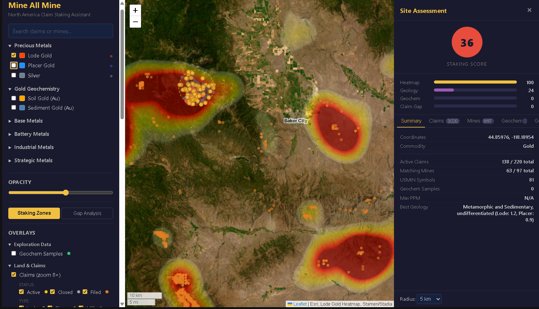
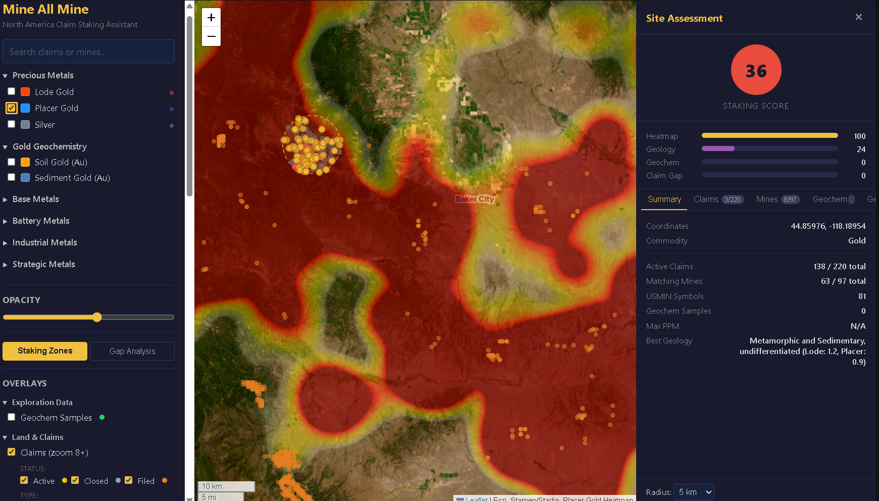
Mineral Heatmaps
Kernel density heatmaps across 39+ mineral commodities from gold to gemstones. See where deposits cluster and identify high-potential areas at a glance.
🎯
Site Assessment
Generate a prospecting score for any location. Geology, geochemistry, nearby deposits, and land status rolled into one actionable number.
🔍
Gap Analysis
Find underexplored areas where geology and geochemistry suggest mineralization but few have looked. Discover what others have missed.
📍
Prospecting Zones
Algorithm-ranked zones highlight the most promising ground based on mineral potential, proximity to known deposits, and geological favorability.
📜
Claims & Land Data
Active mining claims, PLSS grid overlays, and USGS deposit records. Understand the landscape before you head into the field.
💎
Gemstones & Rockhounding
18 gemstone layers: opal, agate, jade, obsidian, sunstone, garnet, sapphire, tourmaline, and more. Backed by USGS MRDS plus 980+ state geological survey localities from Oregon, Idaho, and Washington.